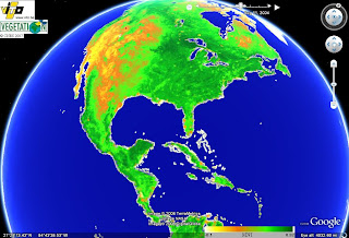
 This KLM data from the VEGETATION program. It is remote sensing of "terrestrial vegetation cover...at the global level." The data is obtained through the VEGETATION1 and VEGETATION2 sensors aboard the SPOT4 and SPOT5 satellites. More information can be found at www.spot-vegitation.com. In using the KLM with Google Earth, One is able to review data from any point on the globe, as well as move through time samples to compare data over time.
Thursday, June 26, 2008
KLM Remote Sensing/ Google Earth
 This KLM data from the VEGETATION program. It is remote sensing of "terrestrial vegetation cover...at the global level." The data is obtained through the VEGETATION1 and VEGETATION2 sensors aboard the SPOT4 and SPOT5 satellites. More information can be found at www.spot-vegitation.com. In using the KLM with Google Earth, One is able to review data from any point on the globe, as well as move through time samples to compare data over time.
Subscribe to:
Post Comments (Atom)
No comments:
Post a Comment