
The above shows the state of Alabama divided by the meridians and lines of the PLSS. Highlighted in blue is Franklin County. A larger scale look at Franklin County with PLSS divisions is below.

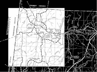
The above map shows Franklin County as a whole, divided by the PLSS system. We will look closer, below, at T6S, R15W. This means we are looking at portion of land 6 Townships south of the Base Line, and we are located in a land portion 15 sections west of Principal Meridian R.
As seen above, state and local borders do not necessarily align with the PLSS System. In particular the difference between the state border on the north from the PLSS system is reflective of the difference between the projections and the PLSS overlay.
All of the above maps can be found at http://www.rootsweb.ancestry.com/~alfrankl/landrecords.htm
No comments:
Post a Comment