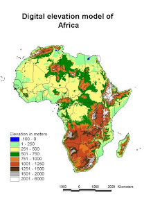
The above image, taken from www.fao.org , shows a digital elevation model (DEM) of the continent of Africa. This particular image is a raster format with a 1x1 kilometer resolution. The information with this map (elevation change when comparing one cell to it's neighbors) was combined with precipitation information to design water flow maps.
No comments:
Post a Comment