 The above map can be found at http://hwwff.cce.cornell.edu/content/unit2/images/usda-hardiness-zones.jpg
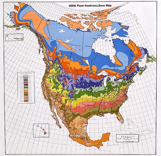
The above isoline map, in this case depicting different "vegetation hardiness zones" shows how different areas of similarity are connected. In this case the areas connected by isolines are the dividing lines between different vegetation hardiness. In all actuality the map is a continuum. The isolines mark the transition from one zone to another, however within the zone (in this case marked by different colors) one will find a range of the variable.
No comments:
Post a Comment