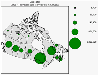
 This image, found at www.statcan.ca/english/Estat/guide/map-mul.htm, shows a range graded proportional circle map of Canada and it's province's populations. The scale at the right provides a frame of reference in judging the population depicted by a particular icon.
Tuesday, July 29, 2008
Range Graded Proportional Circle Map
 This image, found at www.statcan.ca/english/Estat/guide/map-mul.htm, shows a range graded proportional circle map of Canada and it's province's populations. The scale at the right provides a frame of reference in judging the population depicted by a particular icon.
Subscribe to:
Post Comments (Atom)
No comments:
Post a Comment