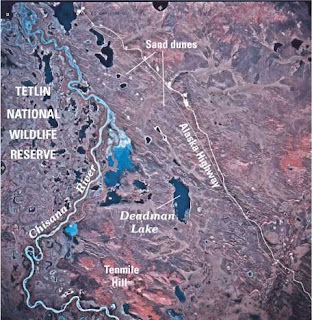
The above image can be found at esp.cr.usgs.gov/info/eolian/task1.html
The image shows Tetlin National Wildlife Preserve. The use of infrared imaging to track ecosystems such as this has aided in conservation efforts. In this image different natural landscapes can be differentiated easily. Vegetation, sparse in this image, appears in reddish tones. Soil (and sand dunes) tend towards brown and greys, while water features are black and/or blue. By providing clear contrasts, these images, when compared over time, assist in tracking vegetative and other environmental change.
No comments:
Post a Comment